Dramatic changes occurred in Harrisburg during what is called the City Beautiful Movement, including the expansion of the city’s capitol complex in the early 20th Century.
The expansion forced many immigrants, minorities, and lower-income citizens who lived behind the capitol, in the city’s Old 8th Ward, to move elsewhere in Harrisburg and beyond. More than 2,000 residents were displaced, and 430 buildings were leveled to make room for the expanded capitol complex.
Thanks to HU Geospatial Technology Professor Albert Sarvis and students involved with HU’s Digital Humanities research project, a comprehensive online map is being created which outlines each former building, who owned the properties, and where former residents of the Old 8th Ward moved as the complex expanded east. The Digital Humanities project also includes a second study overseas that involves the use of drones to survey Greece’s Isthmus of Corinth.
Here at home, Professor Sarvis and students currently are extending their analysis beyond Harrisburg’s Old 8th Ward and are analyzing 3 decades of city population. During the past four years, Professor Sarvis and his students have mapped the Harrisburg population from 1900 to 1930 using census data curated from Ancestory.com and translated by Messiah College faculty and students.
The ongoing work will culminate in the publishing of Harrisburg University’s methodologies and findings in “Pennsylvania History: A Journal of Mid-Atlantic Studies.” The exact print date of the Digital Humanities article has yet to be set, but the publication will contain articles pertaining to Digital Harrisburg. HU has been asked to contribute an article, co-authored by a student and faculty member, which details the Geographic Information Systems (GIS) component of the spatial data development and analysis. The spatial data and analysis also will be published and hosted by HU through an expansion of an interactive online map.
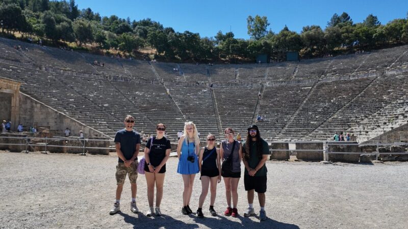
Isthmus of Corinth
Along with Dr. David Pettegrew of Messiah College, Professor Sarvis and students visited Greece twice, and plan to return, to use drones to conduct drone mapping. The Isthmus of Corinth survey dates to May 2017 when Professor Sarvis and Student John Nieves-Jenings traveled with Dr. Pettegrew and a group of Messiah College student to the Ancient Corinth to conduct drone mapping surveys of specific regions in the Isthmus. A second trip was conducted in May 2018 when Professor Sarvis and Student Morgan Wagner returned with Dr. Pettegrew to survey another 300 acres.
Concept drone mapping has produced highly accurate and useful products that have allowed the researchers to document and perfect the methodology of future work. So far, 35 separate flights were undertaken. The flights led to the creation of 12 aerial photo mosaics covering more than 400 acres.
To support the work, HU President Dr. Eric Darr awarded the project a Presidential Research Grant last year, and he awarded the project additional funding to continue progress throughout 2019.
This year, two students have been hired to work from January 1st through the end of June. Each student is focusing on the two components:
- Digital Harrisburg: Emily Niskala is working to refine historic maps of Harrisburg and the location of individual buildings between 1900 and 1930. The initial historic mapping work was completed as part of last year’s first Digital Humanities Presidential Research Grant. This work will allow the “geocoding” of 1900, 1910, 1920 and 1930 census records for Harrisburg. Using census data transcribed and improved by Messiah College students, Niskala will next produce a more accurate geographic representation of these datasets. Upon completion of the census data location improvement work, more detailed analysis of the distribution and characteristics of segments of Harrisburg’s population will be undertaken. This analysis work will occur in late spring to early summer.
- Drone Mapping in the Isthmus of Corinth: Vincent Montello was hired to analyze thermal images captured by a drone in Greece through last year’s Presidential Research Grant. Montello will geo-reference these images to high resolution visual spectrum images captured for areas of particular archeological interest. This effort will help HU and Messiah College faculty determine if the thermal images provide any insight about subsurface structures that may exist at these sites. Vincent began this work in late January and will continue to process imagery through March. A review of these images and any potential patterns they reveal will be conducted in April or May of this year.